Historical Aspects

Sarah Jane Staples Clothing Manufacturing ca, 1890
The substantial, little altered 1880 Mansard roofed frame structure has an abundance of well preserved decorative trim. The Mansard is a hipped gambrel, which slopes in all four directions of the building and bends along each side. The ‘bell cast” Mansard roof is pierced by dormer windows capped with decorative hoods. The hooded drip moulding is more often seen on Gothic Revival styled houses than on local wooden commercial buildings. This window treatment is carried over onto the large first-story store front openings.
The Mansard roof became particularly popular in urban areas where it provided a full attic story of living space and was also commonly used in remodeling older buildings.
Oxford County, Maine: A Guide to its Historic Architecture.-Randall Bennett, 1984.
. The style was popular in France from 1852 to 1870 during the reign of Napoleon III, and was later imported to the United States in the 1860s. The mansard roof is a double-pitched, hip roof with a steep lower slope and a shallow slope on top, and it creates an extra floor of usable attic space. Dormer windows are often used to provide light to this floor.
Modern Fashion
Following the Civil War, a population explosion in the cities and towns of the northern and western United States naturally led to a huge demand for new housing. At the same time, house design books and building parts catalogs were becoming available nationally and streetcars and trains brought newer, more distant suburbs with space for large new houses within commuting distance of major cities. These factors along with a postwar industrial and economic energy resulted in the flowering of a variety of new architectural styles. Overall floor plans and forms became more varied and complex, with styles increasingly defined by the shapes of door and window openings and applied decoration at windows, doors, porches, and particularly front entries.
The Second Empire style was considered to be the modern fashion of the late nineteenth century, mimicking the latest French building styles. Its distinctive Mansard roof was named for an early French architect, Francois Mansart.
Courtesy of the Architectural Style Guide | Historic New England.
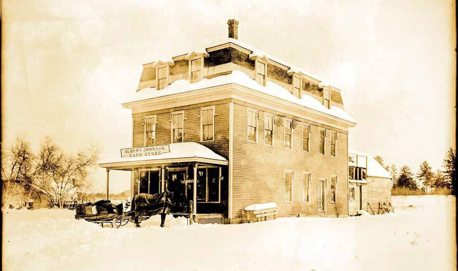
Albert Johnson’s Cash Store in the Village, 1905. Walter A. Wood mowing and reaping machinery was sold here. Albert Johnson was also a blacksmith. The store later went back to making clothes; it was specifically built for commerce.
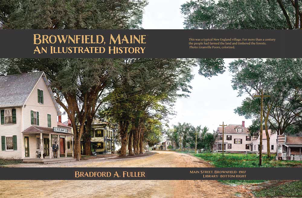
HISTORY OF BROWNFIELD, MAINE
From A Gazetteer of the State of Maine, by Geo. J. Varney
Published by B. B. Russell, 57 Cornhill, Boston, 1886.
BROWNFLELD is situated in the south-western part of Oxford County. Denmark lies on the east, Fryeburg on the north, Hiram and Porter on the south, and the New Hampshire towns of Eaton and Conway on the west. The Saco River comes down through the northern part, then turning eastward, forms part of the eastern boundary. The Portland and Ogdensburg Railroad passes through the town, following the general course of the river. There is much fine interval land along the course of the Saco, through the eastern part of the town, and along the course of its tributary, the South Branch, through the middle of the town from the south west. The ponds are Burnt Meadow, Dyer's and Rattlesnake, each about half a mile in diameter. From near the centre to the southern line is occupied by a group of seven hills. Burnt Meadow Mountain, near Brownfield Centre, is the highest, variously estimated from 500 to 2,000 feet. South Mountain is next in size. On the opposite side of the stream, in the northern half of the town, is a line of three mountains. Frost's Mountain, the eastern one, is estimated variously from 300 to 1500 feet in height. The western line is Tibbet's Mountain, and the middle one is Peary's Mountain. Whale's Back is a solitary eminence near the south-western angle of the town. These mountains are much frequented during the season by lovers of picturesque and extensive views.